There are 51 active speed cameras in San Francisco and Oakland.
In 2026, California has plans to roll out more automated traffic enforcement using speed cameras.
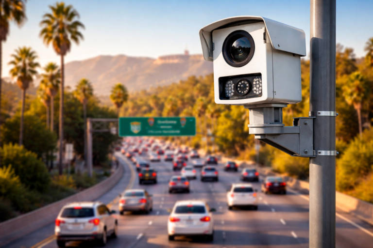
Want to know exactly where California’s speed cameras are hiding? This live map reveals every automated speed enforcement camera across the state. It’s updated continuously by The Ticket Clinic team (Last Updated Jan 2026) to keep drivers informed, aware, and protected. Whether you’re trying to avoid tickets or just drive smarter, this tool puts the latest enforcement zones right at your fingertips.
Oakland Launches Automated Speed Safety Camera Program to Curb Dangerous Driving
The City of Oakland has officially activated its automated speed safety camera program, deploying cameras at 18 locations throughout the city to target speeding and improve roadway safety. The installations are part of a five-year pilot authorized under California Assembly Bill 645, joining San Francisco and other pilot cities in the state in using automated enforcement to address chronic speeding and related crashes.
Under the new program, the technology detects vehicles traveling 11 mph or more over the posted speed limit and captures an image of the vehicle’s rear license plate — no images of drivers are taken and facial recognition is prohibited by law.
To give drivers time to adjust, Oakland is currently in a 60-day warning period during which speeding violations will result only in mailed warnings rather than fines. After this grace period ends — expected in mid-March 2026 — the city will begin issuing citations.
Fines are structured to scale with the degree of the violation, starting at $50 for drivers 11-15 mph over the limit and increasing up to $500 for extreme speeds (e.g., over 100 mph). A key equity feature of the program is an income-based fine reduction scale, which can lower penalties for low-income residents or people on public assistance.
City officials emphasize that the program is meant to change driver behavior and save lives, not primarily to generate revenue. All camera revenue must be reinvested in traffic safety improvements. Oakland’s transportation leaders point to local crash data showing that a small portion of streets — its “High Injury Network” — accounts for a disproportionate share of severe and fatal collisions, guiding where the cameras were placed.
By launching this automated enforcement initiative, Oakland aims to reduce speeding, cut traffic injuries and fatalities, and make city streets safer for pedestrians, cyclists, and drivers alike — while ensuring privacy safeguards and a fair warning period for motorists.
Oakland Speed Cameras (Activate March 15 2026)
Camera ID | Street Segment | Posted Speed Limit |
1 | Martin Luther King Junior Way from 42nd to 43rd St | 30 MPH |
2 | Claremont Avenue from Hillegass to College Ave | 30 MPH |
3 | Foothill Boulevard from Irving St to 24thAve | 25 MPH |
4 | Foothill Boulevard from 19th to 20th Ave | 30 MPH |
5 | 7th Street from Adeline to Linden St | 30 MPH |
6 | West Grand Avenue from Chestnut to Linden St | 30 MPH |
7 | Broadway from 26th to 27th St | 20 MPH |
8 | San Pablo Avenue from Athens Ave to Sycamore St | 25 MPH |
9 | 7th Street from Broadway to Franklin St | 20 MPH |
10 | MacArthur Boulevard from Green Acre Rd to Enos Ave | 30 MPH |
11 | Fruitvale Avenue from Galindo to Logan St | 25 MPH |
12 | International Boulevard from 40th to 41st Ave | 25 MPH |
13 | Hegenberger Road from Spencer to Hawley St | 40 MPH |
14 | 73rd Avenue from Fresno St to Krause Ave | 30MPH |
15 | Bancroft Avenue from 86th to Auseon Ave | 35 MPH |
16 | 98th Avenue from Blake Dr to Gould St | 30 MPH |
17 | 98th Avenue from Cherry to Birch St | 30 MPH |
18 | Bancroft Avenue from 61st to 62nd Ave | 30 MPH |
Active San Francisco Speed Cameras
- 3rd Street from Key Avenue to Jamestown Avenue
- 7th Street from Harrison to Folsom
- 9th Street from Bryant to Harrison
- 10th Street from Harrison to Folsom
- 16th Street from Bryant to Potrero
- Alemany from Farragut to Naglee
- Bay Street from Octavia to Gough
- Bayshore Boulevard from 101 off-ramp to Tunnel Avenue
- Broadway from Powell to Stockton
- Bryant from 2nd to 3rd Street
- Cesar Chavez from Folsom to Harrison
- Cesar Chavez from Indiana to Tennessee
- Columbus Avenue from Lombard to Greenwich
- Embarcadero from Green to Battery
- Franklin Street from Union to Green
- Fulton from Arguello to 2nd Avenue
- Fulton from 42nd Avenue to 43rd Avenue
- Geary from 7th Avenue to 8th Avenue
- Geary from Webster to Buchanan
- Geneva from Prague to Brookdale
- Guerrero from 19th Street to 20th Street
- Harrison from 4th Street to 5th Street
- King Street (NB only) from 4th Street to 5th Street
- Lincoln from 27th Avenue to 28th Avenue
- Market Street from Danvers to Douglass
- Mission Street from 8th Street to 9th Street
- Mission Street from Ottawa to Allison
- Monterey Boulevard from Edna to Congo
- Ocean Avenue from Friday Kahlo to Howth
- San Jose Avenue from 29th Street to 30th Street
- San Jose Avenue from Santa Ynez to Ocean Avenue
- Sloat Boulevard from 41st Avenue to Skyline
- Turk from Van Ness to Polk